So that was it, my Maine experience. As you can see, I seemed to touch upon the preservation of Maine and the ways it can be done. I also visited sites that had a special meaning to me. Hence, LL Bean and Veteran's Memorial Park. I also realized I went to a lot of places in Lewiston. I realized this halfway though the project and I guess i subconsciously wanted to show the world what Lewiston has to offer, although many people think it is a rat hole. I had a lot of fun visiting all the sites and my favorite visit was Mt. Katadhin. If you haven't hiked it you must because its amazing. I learned a lot about the places I visited and that knowledge I will always hold in my mind and hopefully always remember so I can tell the grandchildren.
Lastly I wanted to talk about the Casino that Mainers just voted down this past election period. Since my project focused a lot on the preservation side, I chose the WMDC as a different type of preservation. That preservation is the Maine economy, people and wealth. As you can see, there was a lot of worries about the WMDC but in the long run it helped a lot of families. With the casino I felt as if we had the same opportunity to create jobs. I voted yes for the casino because I knew it would bring jobs to Maine. I asked a friend of mine what he voted on question 2. He said no because he wanted to maintain the beauty of Maine, and especially Oxford. I yelled at him. What he and most Mainers don't realize is, is that we are in midst of a crisis, scratch that, we are in a crisis. A lot of old mills are shutting down and small businesses are closing. Many people have to foreclose on their house because they can't afford them because a they have been laid off or their business had gone bankrupt. All of this effects me personally because someone in my family is being effected by it. The casino was a way to secure at least 900 jobs for Mainers. 900 JOBS!! How can somebody vote no for that many jobs? Not to mention what the casino would have done for all the local businesses because of all the people going to the casino. We can't say there isn't a demand for a casino because look at Hollywood slots and all the people getting on buses to go to Foxwoods. I understand that Mainers are trying to protect Maine and its image, but if we don't have jobs, or a healthy economy, we wont have a image to protect. This casino would have been a great thing for Maine, but because of those Mainers that are those, snide,cautious ones, they screwed many Mainers over. Now this casino company has no plans for building in Maine in the future and are looking else where. This is the only and first time I have ever been disappointed in my State because they didn't look at the facts and voted on a issue that was bigger than themselves but in the end they voted on their personal beliefs which I believe are bullshit.
Now that I got that out, thanks everybody for reading my blog and I hope that you all like it and have learned a lot through my explanations.
Monday, December 8, 2008
LL Bean: December 4, 2008
 For my last and final visit, Ashley and I went to L.L. Bean. We were already heading there to get some Christmas shopping done, so I thought it was a good idea to use LL Bean as my last site visit. We went on a very cold day and it was starting to snow outside. So when we parked, we ran inside because neither of us decided to put on jackets. We rushed to the entrance of the store, where we took each others pictures near the big boot. We have been coming here for years and we have just finally gotten a picture of us near the big boot. We went inside and chaos rained supreme.
There were people everywhere. Trying on shoes, clothes, checking out at the registers, and flipping through the clothes. Everyone had something in their hands and everyone had at least one bag from another place in their hands as well. Once we squeezed our ways through all the crowds, we went upstairs.
Once we were upstairs, we went and looked for some shoes for Ashley's mom. We couldn't find any, so we then went and poked around the store. We looked at all the local grown food and supplies and looked at some of the neat clothes. Once we got our fill of looking around, we went downstairs and looked around the men's section for her dad. We didn't find anything there either, so we both decided to leave before we started spending money on ourselves. By the way, I forgot to mention, that LL Bean has a pound in it with trout in it. How cool is that?!
Historical Significance

L.L. Bean is home away from home for most Mainers. If you need good camping supplies, you go to L.L. Bean. You want to have the best outdoor supplies, you go to L.L Bean. If you are the U.S. Navy Seals and you need certain gear, you go to L.L. Bean. If you are simply visiting Freeport, Maine, you go to L.L. Bean. If you are a Mainer, you are L.L. Bean.
Growing up, I used to be dragged to LL Bean at ten o'clock at night. Since the store is open 24 hours a day, my father thought it was the best time go to LL Bean at nighttime. It was less lines at the checkout and less people in the store. Still you wouldn't believe how many people were still there. The place is like Denny's for teenagers but its for adults instead. I remember being bored out of my mind, while my dad salivated all over the camping supplies and talked to all the employees. I really believe that most of them knew my dad on a first name basis. My dad was so well acquainted with the staff, that they would give him there employee discount when he went to the checkout line. Hey, I'm not complaining to much because I got my first hiking backpack for 40 dollars when it was originally 129 dollars. The employees helped my dad out that much. In addition to buying his own gear, my father set up a contract with LL Bean with the US Navy Seals to get equipment at a really cheap rate if they bought in bulk. My parents are spilt and my dad was a Navy Seal Officer and when he came to visit, he used the excuse that he had to conduct business with LL Bean. This was another reason why we were there so late. So as you can see, LL Bean has a lot of history to me. Today, I love shopping at LL Bean and usually spend about two to three hours in there myself. So all I can say is thanks dad!
LL Bean was first established in 1912 by Leon Bean. Bean was an avid outdoors man and started his business by his invention of the waterproof boot. (I have like twenty pairs of LL Bean boots, hiking boots, ski boots, snow boots, and any type of boot you can think of) He began selling his boot from the basement of his brother's house in Freeport and had a catalogue in which people could order from. He focused a lot of his business towards nonresidents. Eventually Bean's business would skyrocket and today it is a multi-billion dollar business.
LL Bean is historical because its the pride of Mainers. We can say that a Mainer started this business and in Maine it resides. Sure it has other locations, but the first store and headquarters are in Maine. Most if not all Mainers have a piece of LL Bean apparel. If not, your not a Mainer or resident. LL Bean is one of the oldest big time businesses in Maine, and a l ot of people know where Maine is because they have ordered from LL Bean. In addition to being apart of Maine's life, LL Bean gives back to the community it resides in as well as Maine itself.
 ot of people know where Maine is because they have ordered from LL Bean. In addition to being apart of Maine's life, LL Bean gives back to the community it resides in as well as Maine itself.
 Since I work at the Home Depot, I know a lot of things that happen around with big area businesses. One of these businesses that Home Depot deals with is LL Bean. Recently, LL Bean asked my store to send a few people to teach their staff in the ways of energy savings. About four people from my store went to the headquarters in Freeport to teach the executives as well as the employees about energy saving products. This included bathroom, kitchen, plumbing, appliances, wood stoves, heating, water heaters, insulation and various other products. LL Bean asked the Home Depot to teach them about all this stuff because they wanted to lead Maine to an energy saving Maine. They wanted to make their company as energy efficient as possible then preach that upon Maine. LL Bean wants the ability to help promote energy efficient products because of the hard times and the cost of living.
In addition to helping out its community through energy saving products, LL Beans frequently holds concerts outside of the store to entertain the people. At Christmas time, they have a Christmas tree lighting ceremony and they also teach survival, camping and outdoors classes.
LL Bean adds to the economy of Freeport because its the largest business in town plus its the beacon for many shoppers. Because of its big popularity, it helps out a lot of businesses in town as well.
As you can see, LL Bean is another great thing for Maine. Its apart of Maine's identity. Like, Lost on a Mountain in Maine, its part of our culture. L.L Bean is a Mainer.
Resources: Wikipedia, The Home Depot
Wal Mart Distribution Center: November 21, 2008
 On my ninth site visit, I stood outside the Wal Mart Distribution Center. I couldn't go inside because I don't work there, but i stood as close as I could get. Really I stood in the parking lot of Time Warner Cable because I was paying my cable bill. Looking at the giant of a building, all I could see was trucks and a building. It really does block the landscape and it can be seen from miles. There wasn't much movement outside of the building but I'm sure they were busy inside. It was cold that day and brisk for it was on the same day I went and visited Bates Mill and the Veteran's Memorial. Again, I wasn't there long because there was only so much of a big white building one can take in. So after I got my fill, I turned tail and sped off.
 Historical Significance
The Wal Mart DC has only been in Lewiston for a couple of years, but I believe that within those couple of years, It has made history in Lewiston, both bad and good. The plans for the distribution center were first talked about in 2000, then in January of 2002, Wal Mart got a go ahead to start building the complex and it finally opened in June 2005. The building is 48,000 square feet and employees 250 people. Hourly rates start at $13 to $15 depending on work history. I have a few friends that work there and they have way more money then I do. One week, my best friend brought  home a 2000 dollar paycheck, for working overtime plus his hourly rate. However, from there I hear that the work is tedious, and is hard plus the business doesn't treat them so well. By this I mean, they work under very harsh guidelines, one mess-up and you are fired, plus they are timed very strictly on their breaks. You are supposed to work a 8 hour shift but I have known my friends to be there for 15 hours. You can't leave until you are told to or until all your work is done.
 home a 2000 dollar paycheck, for working overtime plus his hourly rate. However, from there I hear that the work is tedious, and is hard plus the business doesn't treat them so well. By this I mean, they work under very harsh guidelines, one mess-up and you are fired, plus they are timed very strictly on their breaks. You are supposed to work a 8 hour shift but I have known my friends to be there for 15 hours. You can't leave until you are told to or until all your work is done.
 The greatest thing that the distribution center has done for Lewiston and its surroundings businesses is give an economic push and give many jobs to the people. Today, jobs in Maine are dwindling by the hour and getting a job is very hard. But the Wal Mart in Auburn, is one of the busiest Wal Marts in New England because of the large area is services. .This Wal Mart alone services roughly 15 towns. Some of those towns include, Oxford, Paris (these towns have a Wal Mart but it isn't large enough) Auburn, Lewiston, Sabattus, Durham, Minot, Mechanic Falls, Turner, Monmouth, Litchfield, and other towns. Because of this Wal Mart, this DC was built and has been very busy since.
Ever since the WMDC has come to town, it seems as if Lewiston has been looking better. More small businesses are thriving and city development has been improving. A lot of people have been flocking to the WMDC for jobs and higher paid wages but the DC has a high turn around rate because not to many people are used to working hard. (I like to call the city of Lewiston, the city of Welfare). The area around the DC was improved as well. A lot of big business have moved in around it, namely Time Warner, Gagne and Sons, and various other residential business. The roads have improved greatly as well in and around the DC. Before, going down these roads one had to swerve to miss a pothole every five feet.
However with all these good things that the WMDC has done for Lewiston, it has come under criticism. People are angry because of the 16.7 million dollar subsides deal i t got from the State of Maine. I say big whoop, this business has done a lot for the town and state by creating jobs. Also, some have complained because at first, the DC was offering jobs that started at 8.50 cents. Again, big whoop, it is still more then minimum wage. However most people are mad and say these things about the DC because they say that WM has broke its promise on providing high paying wages. I got all this information from an article by a very one sided reporter.
 t got from the State of Maine. I say big whoop, this business has done a lot for the town and state by creating jobs. Also, some have complained because at first, the DC was offering jobs that started at 8.50 cents. Again, big whoop, it is still more then minimum wage. However most people are mad and say these things about the DC because they say that WM has broke its promise on providing high paying wages. I got all this information from an article by a very one sided reporter.
 To this reporter and these people, I say get a life and shut up. These are probably the people that are well off and have secured high paying jobs. They don't want to realize how many people now have jobs thanks to the DC and how many people have gotten out of a financial burden/crisis. These are most likely the same people that didn't vote for the casino. (I will talk about the casino in my closing paragraph/statement).
In all, I'm glad that the WMDC came to town because it helped many people. I don't see the WMDC going anywhere but rather enlarging or possible building another building.
Resources: My mind, Lewiston Sun Journal, http://walmartwatch.com/reports/shameless/shameless_lewiston
Tuesday, December 2, 2008
Bates Mill Complex: November 21, 2008
 After I had left Veterans Memorial Park, I went less than a half mile down the road to the Bates Mill Complex. This was one of the quickest visits I had done. I parked along side of t
 he canal and walked close to the mill. Most of the mill has now become shops, so I just wanted to get some photos of the outside. Looking at the mill was cool. It is now rundown and isn't in the shape it used to be. There wasn't anybody around except for the cars driving behind me. After walking around for a few minutes and getting some pictures I left.
Historical Significance
Bates Mill Complex was first established by Benjamin E. Bates in 1850. The mill served as the largest employer in the area until the 1960's. The greater part of the capitol from the mill went towards the founding of Bates College, which is named after Bates. The mill was built in the perfect spot because of the location next to the Androscoggin River and the falls. The mill ran on water power which was one of the most efficient ways to run electricity even today. The river powered the spinning and loom machines. The manufacturing of textiles was the p rime product in the mill, and during the civil war, Bates Mill created much of the uniforms for the Union army. Cotton from the southern states was used to created the Union uniforms. It was stored in warehouses before the war started. The mill spans a great area on the waterfront which you can see in this aerial photo from google earth.
 rime product in the mill, and during the civil war, Bates Mill created much of the uniforms for the Union army. Cotton from the southern states was used to created the Union uniforms. It was stored in warehouses before the war started. The mill spans a great area on the waterfront which you can see in this aerial photo from google earth.
 Thousands of immigrants migrated to Lewiston from Canada and Europe in order to gain employment at the Mill. The mill has a great significance to the Franco-American movement in Lewiston. My Pepe whose name is on the tablets at the nearby Veterans Memorial Park, worked at the mill for almost 40 years. My Meme also worked at the mill for just as long.
After shutting down in the 1960s the mill became run down and started to diminish. The city of Lewiston bought the mill in 1992 in order to maintain it. Soon a private company and eventually TD Banknorth would buy the mill and has gone to great length to refurbish the mill. Many shops are now apart of the mill as well as the L/A Museum and Country Kitchen.
This mill is significant because of the history it has provided for Maine and Lewiston. I wouldn't have enough space to talk about all the things the mill did both good and bad. Plus I don't want to say to much because I'm writing a paper on it. However, the mill has stood the test of time. The many mills are still standing thanks to the preservation attempts by the city of Lewiston and TD Banknorth.

Resources: Wikipedia, Google Eatth
Veterans Memorial Park: November 21, 2008
 For my seventh site visit, I went to the Veterans Memorial Park in Lewiston. The day I went, it was cold, damp, and windy. When I parked I had to walk a little bit to look at the tablets. The
 park is positioned on the side of the Androscoggin River overlooking the falls. The park is neatly kept and the stone tablets tower over the land. As I walked up to the stones, the traffic behind me became silent. The park has a special significance to me because on one of the stones, my pepe who just passed away has his name on the World War II stone. After I looked at all of the stones, I left. I had never been before that day and I was pretty impressed how the park looked.
 One of the most interesting tablets that is there is a tablet dedicated to the U.S.S Maine. The Maine was a ship built in 1897 and was dispatched to Cuba to coax Spain to the let colony go. The ship ended up being blown up and the people blamed Spain. "Remember the Maine" became the chant that everyone was saying in order to push Spain  to let the island have its Independence. On the tablet is a projectile recovered from the U.S.S Maine.
 to let the island have its Independence. On the tablet is a projectile recovered from the U.S.S Maine.
 Historical Significance
The most important thing about this park is that its preserving the memories of all the brave men and women that have fallen for our nation and Maine. The memorial just doesn't have the names of the men and women that have died, but has the names of the serving, served, and deceased. The tablets that are there aren't only from WWII but has the names of any man/women that is in a federal service. Ex. Police, Firefighter, Coast Guard, Military. I think that it is very important to have a memorial, especially in a place like L/A because there is a large population in these towns and a lot of serving men/women come from this area.
The park was created in 2002 and finally dedicated on
November 11, 2002. The park was originally called Heritage Park.
Fort McClary: October 13th, 2008
 For my sixth site visit, Ashley and I visited Fort McClary in Kittery Maine. We were coming back from staying the weekend at Newport, RI and we decided to stop by the fort. It took us a while to get there, because we sort of got lost. We had to stop by the visitors information station on the highway so that the worker could give us a map and directions. Once she showed us how to get there, I realized I missed the Fort by not turning right onto a road. Once we left
 the visitors station, we easily got to the fort in about ten minutes.
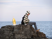
Once you enter the fort, there was a large sign that says Fort McClary and there was a neat parking area as well. We started out by walking along the side of the fort up to the waterfront. There was an awesome view of the ocean and in the bay there was tons of docked sailboats. You are able to walk into the ground in a somewhat cellar. It was dark down there but slightly visible because there were windows built into the side of the cliff walls. You can see this in the picture of me in which it looks like I'm about to get hit by a train.
After this, Ashley an d I climbed our way up to the actual fort. There were a few people inside the fort but in all there wasn't to many people there. In front of the fort, there were a few kids flying kites. This old lady, seeing that we were taking pictures, came up to us and said she would take a picture of us. We went into the fort and looked around. There wasn't to much to see besides the good view and the neat billboards along the walls.
We walked outside and viewed all the tiny buildings to the side of the fort. We walked down into what I think is the cells or barracks and looked around. Other th an looking around and taking in all the sights, there wasn't much to do on that breezy mild day. We ended up only being there for about thirty minutes. Once we got enough of the fort, we went pee and left.
 d I climbed our way up to the actual fort. There were a few people inside the fort but in all there wasn't to many people there. In front of the fort, there were a few kids flying kites. This old lady, seeing that we were taking pictures, came up to us and said she would take a picture of us. We went into the fort and looked around. There wasn't to much to see besides the good view and the neat billboards along the walls.
We walked outside and viewed all the tiny buildings to the side of the fort. We walked down into what I think is the cells or barracks and looked around. Other th
 an looking around and taking in all the sights, there wasn't much to do on that breezy mild day. We ended up only being there for about thirty minutes. Once we got enough of the fort, we went pee and left.
 I thought the fort was really neat, especially learning about Vice President Hannibal Hamlin. I wouldn't mind bringing my kids there in the future because I think this place is a must see attraction. I had fun visiting the fort.
Historical Significance
The fort was built in 1808 after the New Hampshire native Major Andrew McClary who died at the Battle of Bunker Hill. It was most notably used as a defensive fortification during the War of 1812 and during the American Civil War. Vice President Hannibal Hamlin stayed most of the time at the fort during the Civil War. If you go into the fort, you see his picture plastered everywhere.
In the 1910s, the fort went beyond repair and was decommissioned. Many of the forts buildings fell down because of the lack of repair. In World War II, many locals used some of the supports and stone from the fort to use on local fortifications. Once Maine was able to buy the fort from the federal government, an undertaking to preserve the fort went under way. In 1969, the fort was put on the National Register of Historic Places. I believe the biggest lesson one can take from this is that the fort stands there. Yes that is what I mean , the fort stands there. Not to many forts left in Maine are still standing. Maine is taking upon itself a great task to preserve these great fortifications. If it isn't Maine, it is the local townspeople whom try to preserve their heritage and historical sites. Fort McClary stands on the shore of Kittery as a reminder that the Maine people were ready for any enemy attack and to protect its citizens. Yet again, this is a Mainer attempt in preservation of heritage.
Sources: Wikipedia
Tuesday, October 28, 2008
Desert of Maine: October 9th, 2008
 For my 5th cite visit, I went to the Desert of Maine. Thinking I could go and walk around the desert FOR FREE I went there thinking I would have an awesome experience. Instead I had to pay 10 DOLLARS but I still had an awesome experience.
Myself and Ashley were the only ones there besides the workers. With the end of the season for the desert coming just around the corner, I could understand why they made me pay 10 DOLLARS. It was a nice day outside, fairly warm and the sand was dry. At first, we walked into the gift shop, looked around and then proceeded out the back to walk into the desert. When inside the desert, you are allowed to freely walk around and explore. We first checked out the barn and looked at all the neat artifacts. Next we went into the desert. I hadn't been there since I was a kid and being older I could appreciate it much more. I had never seen anything like this before in my life.
 Next we went into the desert. I hadn't been there since I was a kid and being older I could appreciate it much more. I had never seen anything like this before in my life.
 The sand looked like actually desert sand but there were bright green trees around the perimeter of the desert. There was also running water along the sides of the sand and I also found a mushroom growing in the middle of the desert. Besides walking the trails, there wasn't much else to do in the desert. In order to keep you entertained, the workers put up neat signs around the desert that had cool facts about the place. So Ashley and I walked around looking at all the signs, but after walking around for about 45 minutes we called it quits and left. However before we left, I had to get a picture of the camel and its little baby. Historical Significance
Historical SignificanceThe Desert of Maine, is the only desert found in Maine and is formed naturally. The desert of Maine is 40 acres of glaciers sand, located in the middle of the woods in Freeport, Maine. Before the desert became a desert, it was a farm land. The farm land was owned by the Tuttle family. Mr. Tuttle, a wealthy man from Boston, moved to Freeport to start a farm and try is hand at farm work. They purchased the land in 1797. After years of not rotating the crops and overgrazing by animals, the land started to turn up glacier sand. Eventually the sand would overcome 40 acres of the Tuttle's land and in 1919, they abandoned the land. In the same year, Henry Goldrup purchased the land for 300 dollars and in 1925 made it into a tourist attraction.
The workers that work there are always learning reasons why the sand appeared on the land. What the workers have come to find out, through universities and archaeologists, that the land actually sits on a lake bed. They believe that the land was sucked up by the lake, forming the sand that is there now. The sand rose so high that in some places of the desert, the sand rises more than 100 feet. If you walk to the edges of the desert you can see just how high the sand is. However, even though there is plenty of sand, vegetation is starting to take back the land. Grass and trees are starting to grow on the sand, hinting that the land might turn fruitful once more. If you look closely at the sand, you can see that the sand isn't really real desert sand but glacier sand that freezes in mid-winter.
 high the sand is. However, even though there is plenty of sand, vegetation is starting to take back the land. Grass and trees are starting to grow on the sand, hinting that the land might turn fruitful once more. If you look closely at the sand, you can see that the sand isn't really real desert sand but glacier sand that freezes in mid-winter.
 Over the years the Desert of Maine has been subject to many scholars. Archaeologists have come from all over to study the land in the desert and many tourists come to see this phenomenon. The Desert of Maine is significant to Maine because Maine is the only state in New England that has a so called "desert." It adds to the economy of Maine by leading tourists to Maine, plus it adds to the history of Maine. For once this isn't an example of preservation because the land was specifically bought for the purpose of leading tourists to this cite. However, the money that is made goes towards the preservation of the 300 year old barn sitting next to the gift shop. So I guess that this is an example of preservation in a small way. (Maine is all about preservation) Hopefully the Desert of Maine sticks around Maine for many years to come but it looks like mother nature might want her beloved land back.
Resources: The Desert of Maine workers, Wikipedia
Monday, October 27, 2008
Thorncrag Bird Sanctuary, September 24th 2008
 Living only a half a mile from Thorncrag Bird Sanctuary, it only took me two minutes to get there by car. I decided to go there the day after Peeks Island because I was in an "get homework done" mood and the weather was very warm that day. So wearing shorts and t-shirt, Ashley (my fiancee) and I made our way into the trails of the Sanctuary. We have been here many times before but not since the recent construction of the new parking lot and revamping of the trails. We usually take the red trail but today we decided to take the white and blue trails with the intention of ending up at the grand fireplace.
 With the weather getting co ld, the sanctuary was surprisingly green and full of life. We saw many birds, squirrels, and bees, but we managed to avoid ticks. Along the way we came across many ponds but there is a fairly large pond with benches at it. Also along the trails are plaques, such as the one above. I had Ashley take a picture of me in front of a pond, as proof that I was there.
We sat at many of the benches along the way, to rest and take pictures. When we got to the fireplace, Ashley and I had a picnic. After eating we made videos of us dancing, and doing silly things. After about an hour we made our way down the green trail back towards the car. We didn't stay long, because the polish man that I am, wore shorts in late September. Although the weather was warm when we arrived, it was cold by the time that we left.
ld, the sanctuary was surprisingly green and full of life. We saw many birds, squirrels, and bees, but we managed to avoid ticks. Along the way we came across many ponds but there is a fairly large pond with benches at it. Also along the trails are plaques, such as the one above. I had Ashley take a picture of me in front of a pond, as proof that I was there.We sat at many of the benches along the way, to rest and take pictures. When we got to the fireplace, Ashley and I had a picnic. After eating we made videos of us dancing, and doing silly things. After about an hour we made our way down the green trail back towards the car. We didn't stay long, because the polish man that I am, wore shorts in late September. Although the weather was warm when we arrived, it was cold by the time that we left.
Historical Significance
Thornscrag is a tourist attraction but not as much as Old Orchard, or Lewiston. Really, Thornscrag is primarily used as a place for locals to find peace from the world. It is a quiet place where locals can walk their dogs, run, walk, or have a picnic. This is what Ashley and I did. Thornscrag isn't only a free nature trail, but a bird sanctuary. There are a few birds that dwell within Thornscrag that are not found in the entire state of Maine.
Thornscrag was originally home of Elder Thorn as farmland and eventually belonging to the Highland Spring Water Bottle Company. Thornscrag would become a 357 acre wildlife preserve. Surrounding it are the suburban and commercial life of Lewiston. The fire place that sits upon the "Crag" is the highest point in Lewiston. Thornscrag has been a bird and wildlife sanctuary for more than 80 years.
 This place is significant because it represents the community that it resides in. All forms of people come to visit this place and it houses sanctuary for many people. Also many activities for certain groups, such as the boy/girls scouts and Bates College, are held at Thornscrag. Again, we see another sign of preservation in Maine life. As a whole we see the local peoples outreach towards a attempt to preserve the life around them.
Wednesday, October 22, 2008
Battery Steel: Wednesday September 23, 2008
 On Wednesday September 23, 2008 my friends and I went to Peaks Island in search for a cave. What is funny is that I went to this Island not knowing that I could go there for one of my site visits and I didn't know that Battery Steel even existed. We took the ferry over to Peak's Island around 3:15 and got to the Island at 3:45. When we arrived we all went to the potty and then we set out in search for this cave that we were looking for. It was a pretty moderate day outside, warm enough to wear a t-shirt and shorts. There weren't many people on the Island so it felt like we had the whole Island to ourselves. We started out by walking through the nature trail, thinking that a cave would be in the woods. To our unliking, we found no "cave." After about an hour of walking, we came up to Battery Steel. The entrance in the middle was flooded, so the only way we could get inside was to start at the ends.
Battery Steel is a huge tunnel built into the side of a hill. When inside it is completely dark and you need a flashlight in order to see. We only had a little maglight flashlight for all five of us, so we all grouped in a small huddle and made our way down the dark and spooky tunnel. The walls were covered in graffiti and we found lots of beer cans. Along the sides were old jail cell rooms, that had no doors and looking across the tops of the ceilings you could see old gas tube lines that supplied the light back in the day Battery Steele was operational. As we walked down the tunnel we came across something that scared us all.


As we made our way down the tunnel, Tony, stopped suddenly and yelled that we saw something. (Tony was the one holding the flashlight) We all disagreed with him. So Tony held the flashlight out in front of the entrance that he had saw this "creature" and I slowly peaked into the entrance. What I saw was this big white thing with two very big black eyes. I screamed, everybody else screamed and before I knew it we were all running for the light at t he end of the tunnel. We all made it out and after calming down, we decided to go back and make sure that this thing wasn't a dead body. (Aaron came up with this idea that what Tony and I saw was a dead body) So we slowly made our way back into the tunnel to the entrance of the creature. This time Tony and I looked at the same time and what we thought that we saw wasn't a creature or dead body but a white army man painted on the side of the wall. You can see it in this picture. You see the the white man at the end of the tunnel to the left? This is what scared us all. I mean come on, who wouldn't jump or scream by just quickly looking at this from a distance. Anyways, after we laughed at ourselves for a while, we continued on, exploring the the rooms and side tunnels until we came to the other end of the main tunnel. We went to the backside of Battery Steele, which faces the oc
 ean.
ean.
 he end of the tunnel. We all made it out and after calming down, we decided to go back and make sure that this thing wasn't a dead body. (Aaron came up with this idea that what Tony and I saw was a dead body) So we slowly made our way back into the tunnel to the entrance of the creature. This time Tony and I looked at the same time and what we thought that we saw wasn't a creature or dead body but a white army man painted on the side of the wall. You can see it in this picture. You see the the white man at the end of the tunnel to the left? This is what scared us all. I mean come on, who wouldn't jump or scream by just quickly looking at this from a distance. Anyways, after we laughed at ourselves for a while, we continued on, exploring the the rooms and side tunnels until we came to the other end of the main tunnel. We went to the backside of Battery Steele, which faces the oc
 ean.
ean. We climbed on top of Battery Steel and we all sat there for a while looking out into the ocean. We then decided it was time to leave but before we did we went back into the tunnel were Aaron took this picture of me. (I'm using it as proof that I was there)

After this we all left the Steel, with scared memories and pleasant adventures. I'll never forget that army man and I'll never forget the time I almost was scared to death.
Historical Significance
In World War I and in World War II, Peaks Island was used for military operations. As one of their many defense outposts, Battery Steel was created for observation and defensive purposes. Battery Steel was part of Portland's defensive system. Battery Steel has rooms to accommodate prisoners and soldiers. In World War I only a little control bunker was created but during World War II a larger and better command center was created, Battery Steel. Battery Steel isn't the only bunker on Peaks Island. The military created the bunker Cravens, that is only a little smaller than Battery Steel.
Battery Steel is 600ft long with two 16 foot long gun emplacements. These two large guns added to the defensive of the island and the defensive of Portland harbor. Now Battery Steel is completely deserted, privately owned but open to the public. There is a lot of debris everywhere and vandals have used graffiti on most of the walls. There are trip hazards, this is why you need a flashlight when visiting.
Battery Steel is important to Maine because it shows Maine's involvement in both of the World Wars. By creating defensive bunkers, Maine was ready for the invasion of Germany or any other foreign enemy. This showed Maine's partiotism and showed that Mainers don't sit on their hands when their country or fellow Americans ask for help. (cough, unlike Massachusetts, cough.)
Battery Steel is one of the few old military sites and forts that are still accessible and standing. I think that because Battery Steel is privately owned, the inhabitants take pride in trying to preserve the bunker because it is part of the island history. If the government still owned the bunker I believe that the bunker would be gone. Again this bunker is yet another example of preservation.
Resources: Wikipedia, http://www.elofson.org/Military/Military1.html
Tuesday, October 21, 2008
Old Orchard Beach, September 13th, 2008
 On Saturday September 13th, my friends and i visited Old Orchard Beach. It was the start of the school year and as our yearly tradition, (we had not seen each other all summer), we went to the beach on the first of the weekend in order to hang out and have fun. It was a warm day for September, and we were able to lie on the beach and catch some sun. We didn't go into the water because the weather wasn't that warm. There happened to be a lot of college students there, mostly from USM, and we recognized many of them. We sat on the beach most of the day. There were quite a lot of tourists there too. This is the finial days for Old Orchard Beach, and many shops were having 50% off sales because they were about to close up for the fall and winter. However, there were a few stores that were staying open through October. Palace Playland was open but not many rides were going. The Ferris wheel above was broken and was not operational. When it started to get colder outside, my friends and I packed our belongings and headed back to school. However before we left, we took a picture of all of us in a gazebo that we had parked next to.
Historical Significance
When I think of Old Orchard Beach i think of two things, the big Ferris wheel and the pier. These two things are implanted in most beach goers and most tourists. Old Orchard Beach has a long Maine history and is one of the oldest towns that Maine has.
Old Orchard Beach was established by Thomas Rogers in 1657 but in most textbooks the town was seen as a settlement in 1658. The length of the beach is eleven miles. Before this beach town even became an official town, Old Orchard Beach was a popular getaway and tourists attraction in 1631. Tourists would stay at local farms, paying them for room and board. Eventually a train route was built between Boston and Portland and Old Orchard Beach was one stop between these two cities.
One of the many things that Old Orchard Beach has is an abundance of shops and taverns. The main drag of the beach is covered in tourists shops and t-shirt stands. Palace Playland is the only amusement park in Maine that is built on a beach and beach goers can freely walk around the park or use its rides and games. In addition to having all the shops and the amusement park, the highlight of the beach is the pier.
The pier originally built in 1898 was 1,770 feet long built out of steel with a casino at the end of it. The casino housed a ballroom the could accommodate 5,000 dancers. A storm eventually destroyed some of the pier and the pier was shortened by 170 feet. Ten years after this storm another storm hit the pier and destroyed it. The pier was rebuilt out of wood but was reduced to only 700 feet in length.
Tourism is the biggest thing that Old Orchard Beach has and this is what it will always have. Old Orchard's revenue from its tourist season greatly helps Maine economy. OOB is significant to Maine because without it the economy in Maine wouldn't be where it is today. Since Maine's economy is heavily dependant on the tourists that visit the state, with Old Orchard Beach's attraction, the contribution alone shows its importance to the state of Maine.
Resources: Wikipedia
Monday, October 20, 2008
Baxter State Park, August 10th, 2008
 On August 10th, 2008, my brother and I hiked Mt. Katahdin in Maine's Baxter State Park. It was a warm summer’s day with little clouds in the sky. We started to climb the mountain at nine o'clock in the morning and didn't return until six at night. The hike up was a steep climb up, with big boulders and great scenery. At one point we hiked through a cloud and you couldn't see anything that was ten feet away. On the way up we meet up with a guy that had climbed the mountain 278 times in a 30 year span and usually goes up the mountain 15 times a year. This man was 70 years old and could hike up and down the mountain in 4 hours total. He worked on the trail marking it for the hikers that ventured up the mountain. After we had stopped and chatted with the man half way up the mountain, we continued our hike up and met up with two men and a little girl. These people were part of a larger group full of a little girls soccer team climbing the mountain as a team adventure. We talked with them for a while and then made our way up the mountain.
When we got to the top, the mountain was flat and clouds covered the view. We stopped and rested, and then we had to hike another mile up to get to the summit of the mountain. Getting to the summit is by far the biggest goal i have ever accomplished. The view was spectacular. You could see miles and miles of green forest and large lakes looked like puddles. You could see other mountains in the distance but they looked small as well
 because we were so high up. I could literally reach up and touch a cloud. On top of the mountain, there were crowds of hikers resting and rejoicing the same as my brother and I were. We had conversations with the fellow hikers and we ate lunch by ourselves on a edge of a rock. I will say this, the top of mountain is full of ticks. They were everywhere, and I was constantly swiping them off of myself.
After an hour or two resting on top of the mountain, my brother and I started our descent down the mountain. As we went down, the clouds on top of the mountain cleared and we saw even better views than what we had previously saw. We got so intrigued by the sight that we didn't even notice that we had gotten off the trail and we were descending down the mountain on no actual trail. We were literally rock climbing our way down the mountain. After going down the mountain about a mile, we knew that we were so lost that we stopped and chatted about our predicament. My brother and I decided to climb back up and find the actual trail. After using all the energy and adrenaline in my body, we made it back to the top of the mountain and i collapsed. It was getting late and we knew we had to get back so we very slowly descended the mountain and after two hours of anguish we made it to our campsite. Together, we made a fire, had supper and cracked open couple of beers. After we relaxed for a while, we went to sleep and slept very soundly.
Historical Significance
Mount Katadhin is the largest mountain in Maine and is one of the prime destinations for Mainers, hikers and vacationers. There is a large historical background of Mt. Katadhin and we must give thanks to Governor Baxter for preserving that history and preserving one of Maine’s great attractions.
Mount Katadhin is part of Baxter State Park. In the 1930s Governor Percival Baxter began to acquire land and finally deeded more than 200,000 acres to the State of Maine for a park, named Baxter State Park after him. Residing within the park is Mount Katahdin. The Penobscot Indians, native Indians that lived closest to the mountain, called the mountain Katahdin, which in their language means “the great mountain.” A couple of US Navy battle ships have been named after Mount Katahdin. Henry David Thoreau was one famous person that climbed the mountain as well as many other notable people.
Mount Katadhin is also part of the Appalachian Trail. Depending on which way you are traveling the Appalachian Trail, it is either the first or last stop of the trail. It is part of what is known as the nature trail in Maine. This trail, a part of the Appalachian Trail, is considered by most hikers the most grueling section of the Appalachian Trail. With thick forests and steep hills and mountains, the nature trail lies dormant mostly inside Baxter State Park. There are many different paths that lead to the summit of Mount Katahdin and among those the hardest is Knifes Edge. This trial is merely two feet wide, open to the elements and lies on top of the mountain. If you slip or make a wrong move, it could mean that you might fall to your death down the mountain.

One of the biggest reasons why Mount Katahdin is important is because it symbolizes preservation. Governor Baxter’s generous donation of 200,000 acres marks the largest land preservation in New England. From all over people come to the park, and among those, Canadians travel down from New Brunswick or Quebec to climb the mountain. The mountain adds to Maine’s tourist attractions and helps preserve Maine’s economy as a vacation and destination state.
Resources: Wikipedia, Baxter State Park Website
Purpose
This blog is intended for one purpose and one purpose only. It is intended for the use of a project in my HTY 360: History of Maine Class. I am to visit 10 historical sites in my native state of Maine and write about my experiences visiting those sites as well as a brief history of each site. My page will include pictures and other additional items. Feel free to comment on each of my postings and to ask any questions that you may have. If you are looking for any additional pictures feel free to ask for more. This pictures taken on top of Mount Katadhin are breath taking. So without further ado, this is my Maine experience through my eyes.
Subscribe to:
Posts (Atom)